


Image Source: EOSDA
EOSDA LandViewer is an advanced geospatial platform that is changing how satellite images are used in various fields. It offers easy access to a large collection of high-quality images of the Earth, ranging from historical data to near real-time photos. This helps professionals in agriculture, city planning, environmental monitoring, and disaster response. The platform is easy to use and comes with strong analytical tools, enabling users to detect changes, analyze data over time, and perform detailed geospatial assessments. It has a vast satellite database with more than 20 indices and band settings, providing targeted insights into land use, infrastructure, and natural events. Whether for business, research, or government needs, EOSDA LandViewer delivers trustworthy information to support smart decision-making.
Why Access to Archived Satellite Imagery Matters
Historical satellite images provide important insights into the past, which are essential for planning future actions. This valuable information supports trend analysis, environmental tracking, and long-term strategies in various fields. By studying past satellite data, experts can identify changes in land use, evaluate the effects of events like deforestation or wildfires, monitor crop health, and observe urban expansion. These findings help ensure compliance with regulations and guide future planning.
EOSDA LandViewer enhances these advantages with features such as change detection, time-series visualization, and time-lapse animations. The platform enables users to easily see changes in natural disasters, urban development, and environmental shifts, offering high-resolution data in accessible formats like GeoTIFFs. Whether dealing with disaster recovery, promoting sustainable farming, or planning city infrastructure, access to satellite historical imagery provides decision-makers with the accurate, data-driven insights necessary for creating effective, sustainable strategies.
Key Features of EOSDA LandViewer
EOSDA LandViewer stands out with a robust suite of features designed to empower users with precise, historical, and near real-time satellite data. One of its primary strengths is the extensive archive of satellite data. Users can access historical satellite images of a location from a diverse range of satellite providers including Sentinel-2, Landsat-8, MODIS, and various commercial high-resolution satellites. The platform’s rich archive, dating back to 1972 with the launch of Landsat-1, is a testament to decades of Earth observation. Over the years, multiple Landsat satellites, along with support from Terra, Aqua MODIS, Sentinel missions, and CBERS, have contributed billions of historical images, ensuring a comprehensive dataset for any analysis.
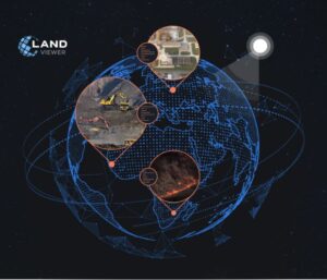
Image Source: EOSDA
Complementing this vast archive are the time-series graphs. This feature leverages spatiotemporal analysis by generating detailed vegetation index graphs based on NDVI, as well as index graphs for NDWI and NDSI. These graphs enable users to monitor vegetation growth, assess changes in land use, and identify key crop development stages over specific periods. With an intuitive interface, users can zoom in on any point in time, making it easier to track dynamic changes across their areas of interest.
Another innovative feature is the time-lapse animation tool. By transforming static pictures into engaging animated sequences, this tool vividly illustrates changes over time — whether it’s urban expansion, deforestation, or environmental shifts like ice sheet cracking. These animations, available in GIF or video formats, are not only useful for scientific and commercial analysis but also for enhancing presentations and communicating findings on social media.
Together, these key features of EOSDA LandViewer provide a powerful, data-driven approach to understanding our planet’s past and predicting its future, making it an indispensable tool for researchers, planners, and decision-makers alike.
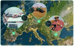
Industry Applications of EOSDA LandViewer
EOSDA LandViewer is transforming how industries use current and historical satellite imagery for actionable insights. In agriculture, high-resolution data helps assess weather and disaster impacts on crops, providing farmers and insurers with detailed damage maps. Historical land use analysis identifies trends in crop health and pest issues, fostering resilient strategies. The platform also aids in pasture management, urban agriculture, and agroforestry.
In construction, the platform enhances site selection and planning with insights on terrain and infrastructure. It enables near real-time monitoring of projects and assesses infrastructure damage post-disaster for efficient recovery.
For environmental applications, EOSDA LandViewer monitors deforestation, climate change impacts, and disaster responses by tracking forest cover and urban expansion. It helps researchers analyze water quality and coastal zones, aiding conservation and policy efforts, while also detecting illegal mining and monitoring wildfires.
Beyond these sectors, the platform is beneficial in forestry, city planning, real estate, insurance, mining, energy, and oil and gas.
EOSDA LandViewer provides an easy and cost-effective way to access a large library of documented satellite pictures of Earth. This tool is useful for businesses and organizations in many areas, including agriculture, research, urban planning, and disaster response. Accessing historical satellite data is essential for analyzing past trends, monitoring environmental shifts, and improving processes. With advanced filtering options, image processing tools, and seamless integration capabilities, this platform is an essential and cutting-edge resource for any field that relies on accurate geospatial data for informed decision-making.